
East Riding of Yorkshire Council Customer Insight Postcode Segments
- We have created a bespoke Customer Insight segmentation tool to better understand the population of the East Riding.
- Each East Riding postcode falls within 1 of 10 segments, each of which is outlined below.
- Each segment has its own characteristics. For example: age, qualifications, broadband speeds.
- For more information regarding our Customer Insight segments, please email intel-hub@eastriding.gov.uk
Use the magnifying glass in the upper right corner of the map to search for your own postcode!
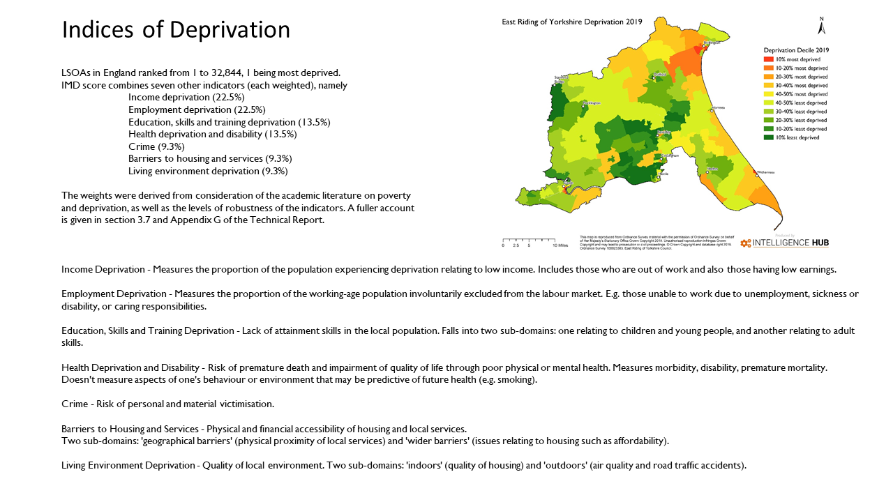
Use the banner above to navigate the profiles. You can use the “Top” button at the bottom right of the page to return to the top of the page. To view a description of the Index of Multiple Deprivation (IMD) click here.
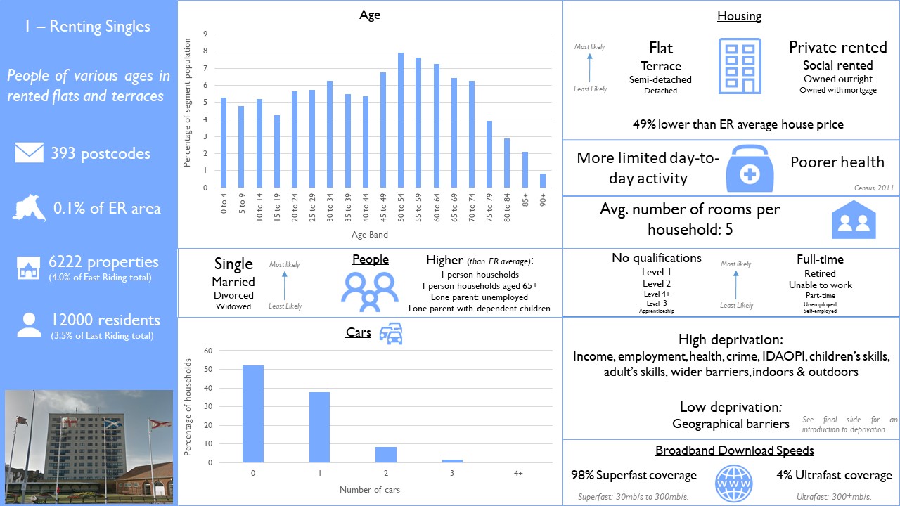
Renting Singles
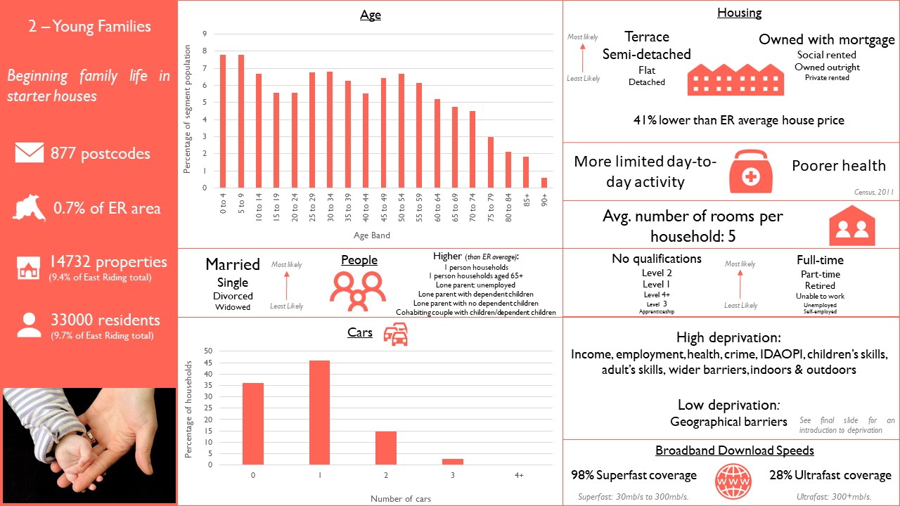
Young Families
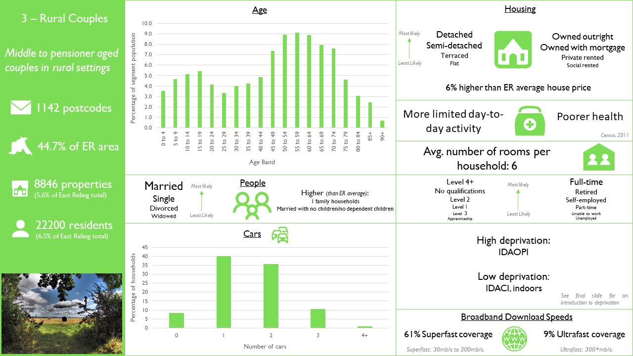
Rural Couples
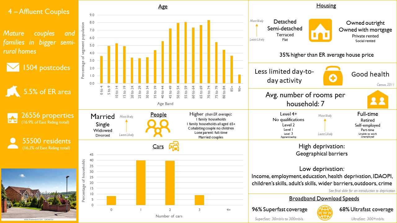
Affluent Couples
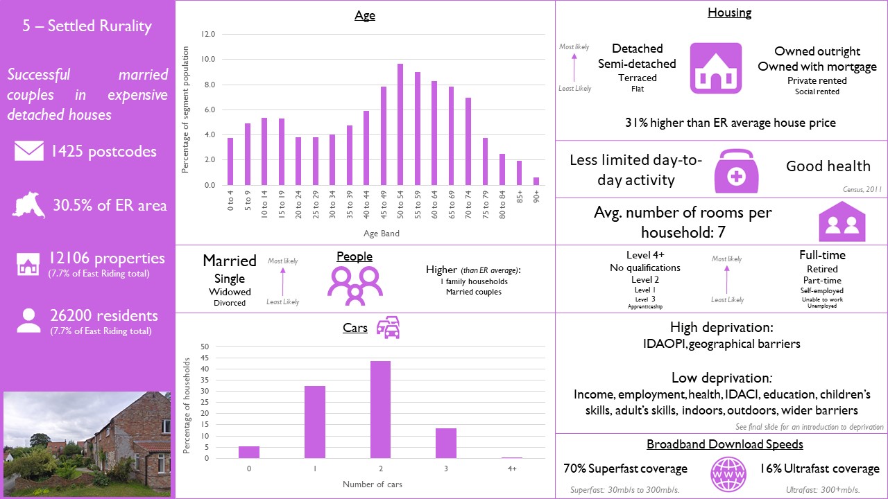
Settled Rurality
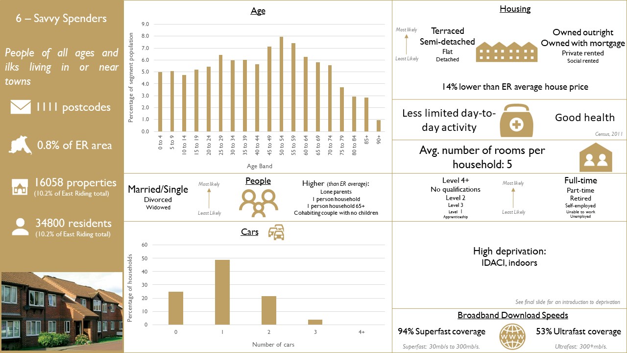
Savvy Spenders
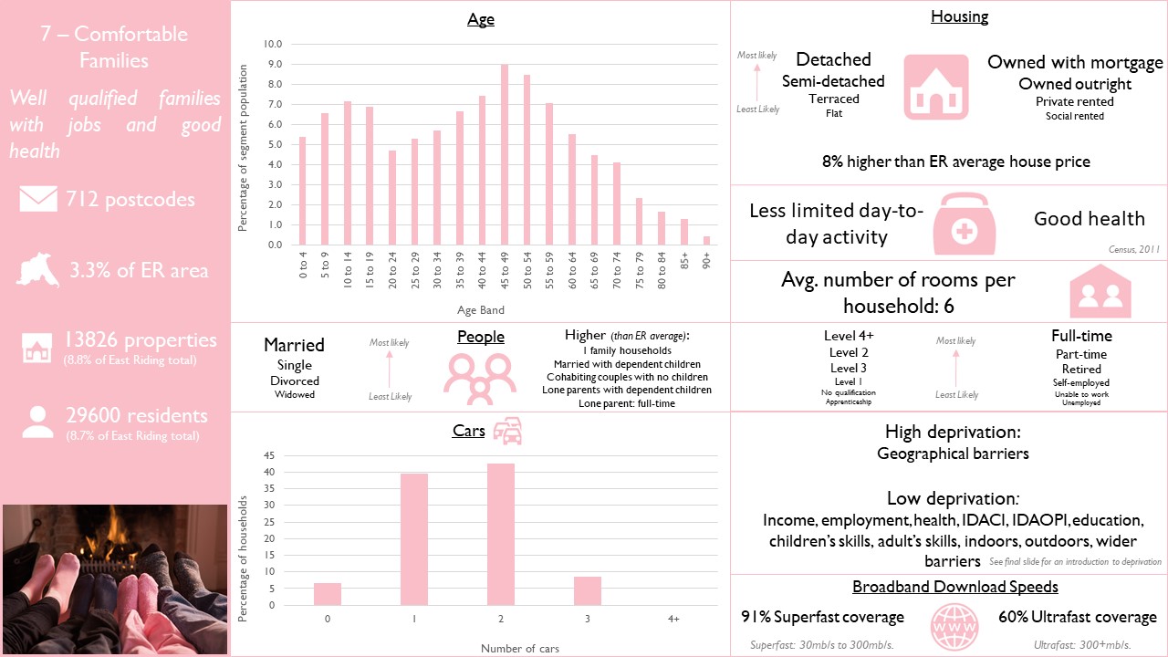
Comfortable Families
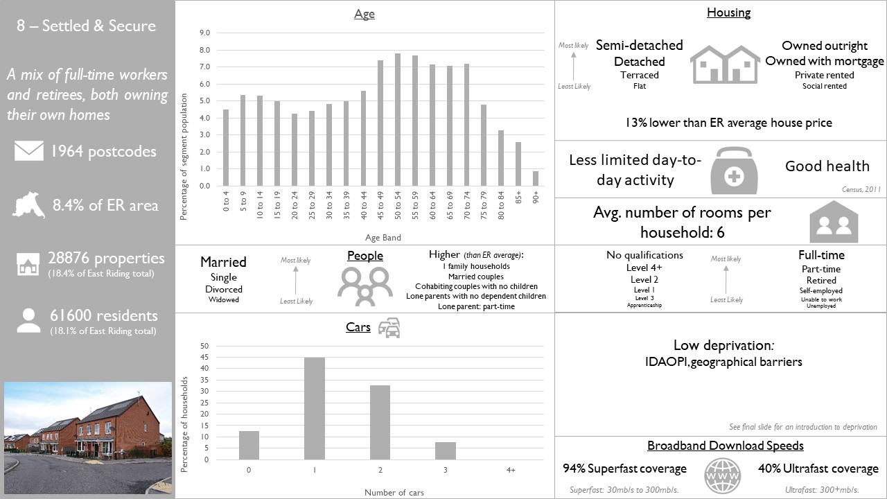
Settled & Secure
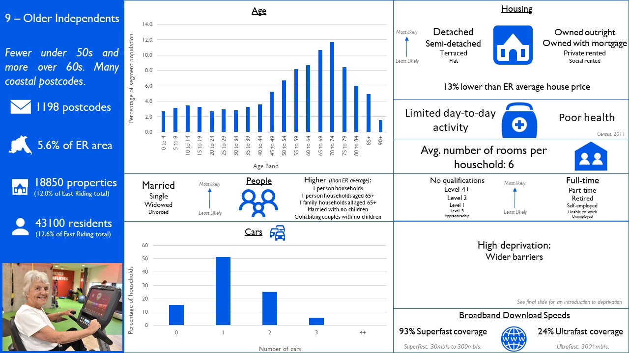
Older Independents
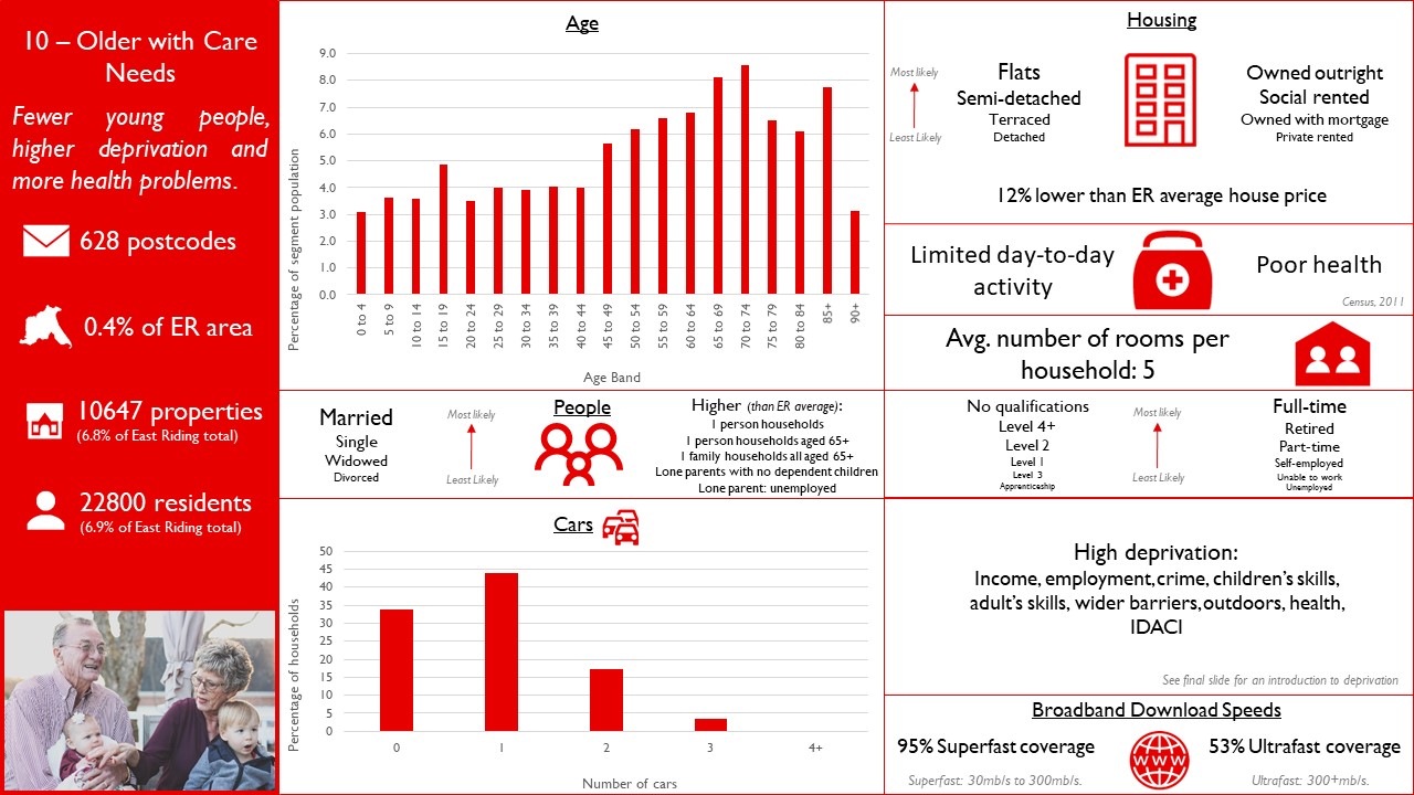
Older With Care Needs
Index of Multiple Deprivation
Last Updated on March 1, 2022